Below are maps showing The Crab Line in relation to places of interest in the immediate locality.
We also have a weather map at the bottom of the page.
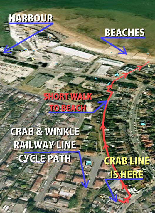
Map 3 shows the short walk to the beach, going along a footpath allowing you to walk off the road. The end of the alley meets a Zebra crossing to cross the road to the beach. Breakfast at the Beach Cafe
Straight round to the Continental Hotel and The Bubble Cafe overlooking the sea.
Turn left to go to Whitstable Harbour.
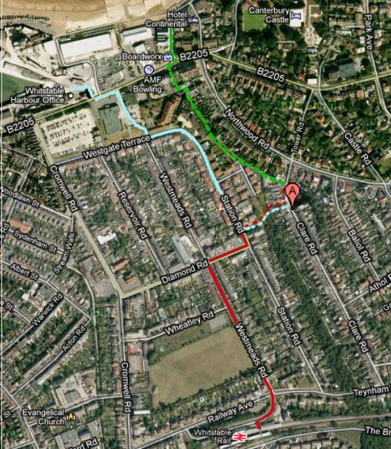
Click maps to Enlarge
Map 1
Walking Routes
Red lines = From Whitstable Station to Crab Line
Green dash = To the beach 400m
Blue = To the harbour
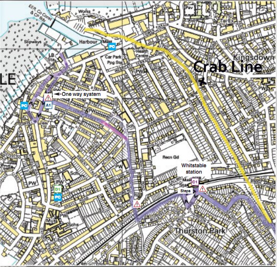
Map 2
Cycle route
Yellow= Original route
Purple= Cycle path from Whitstable town
Map 3
Ariel View
Walking to nearest beach from the Crab Line
This route shows the alley way staying off the main road (Northwood Road)
Red= To the beach